Like the look of this property?
We would love to hear from you and arrange a viewing of this property. Get in touch now!
Property features
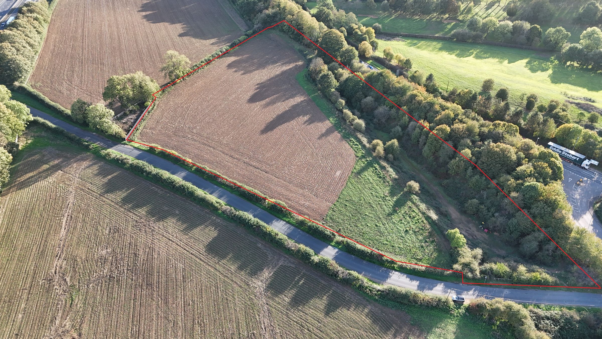
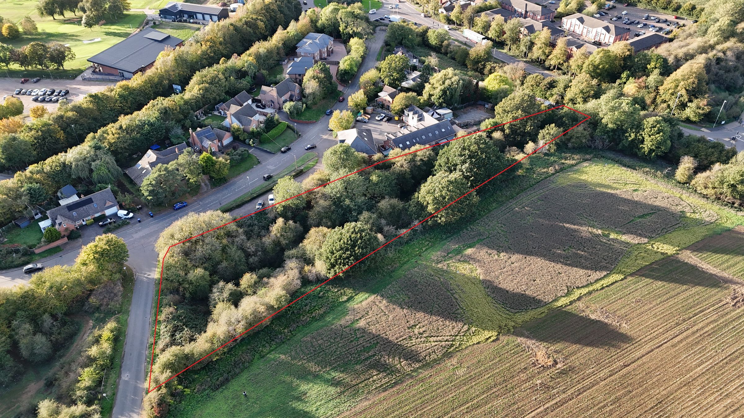
7.7 acres (3.12 hectares) of land, strategically located on the edge of Lutterworth.
Roadside access and frontage
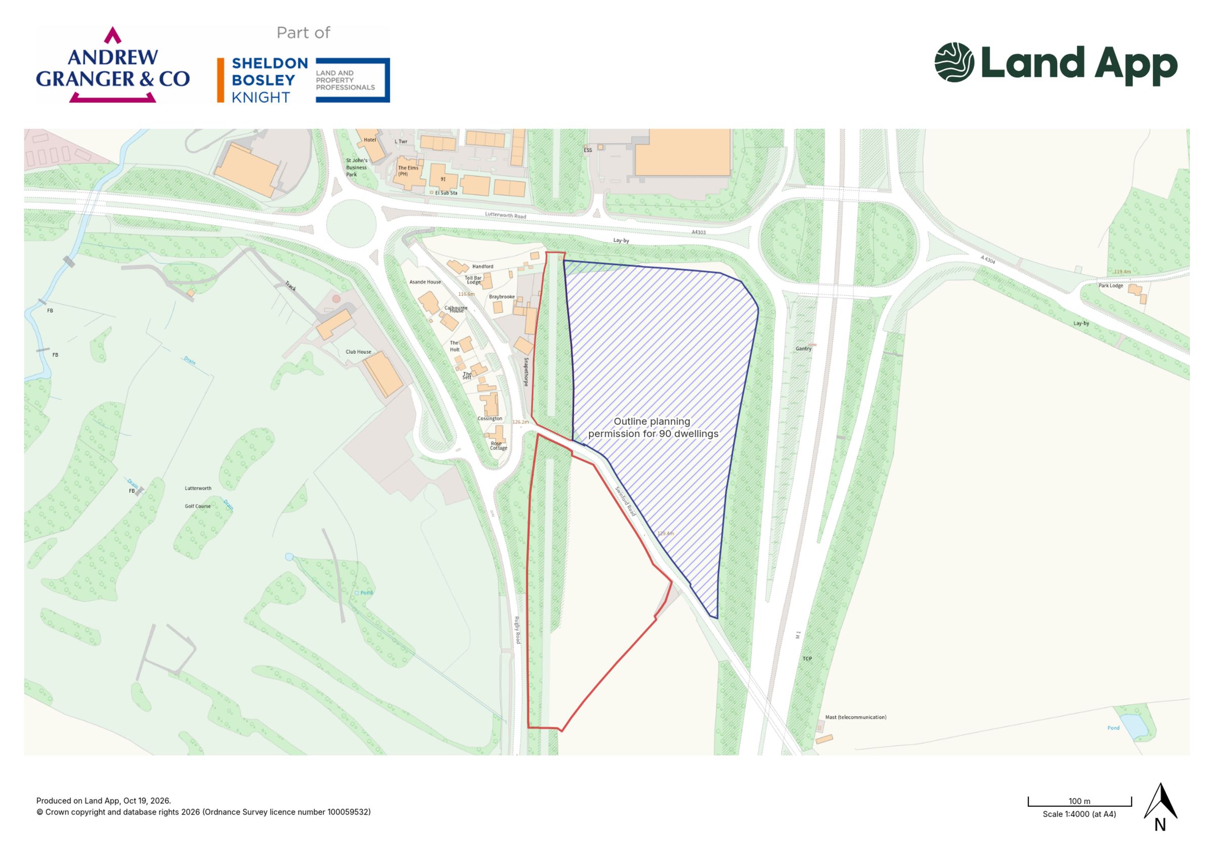
Neighbouring land benefits from outline planning permission for 90 dwellings.
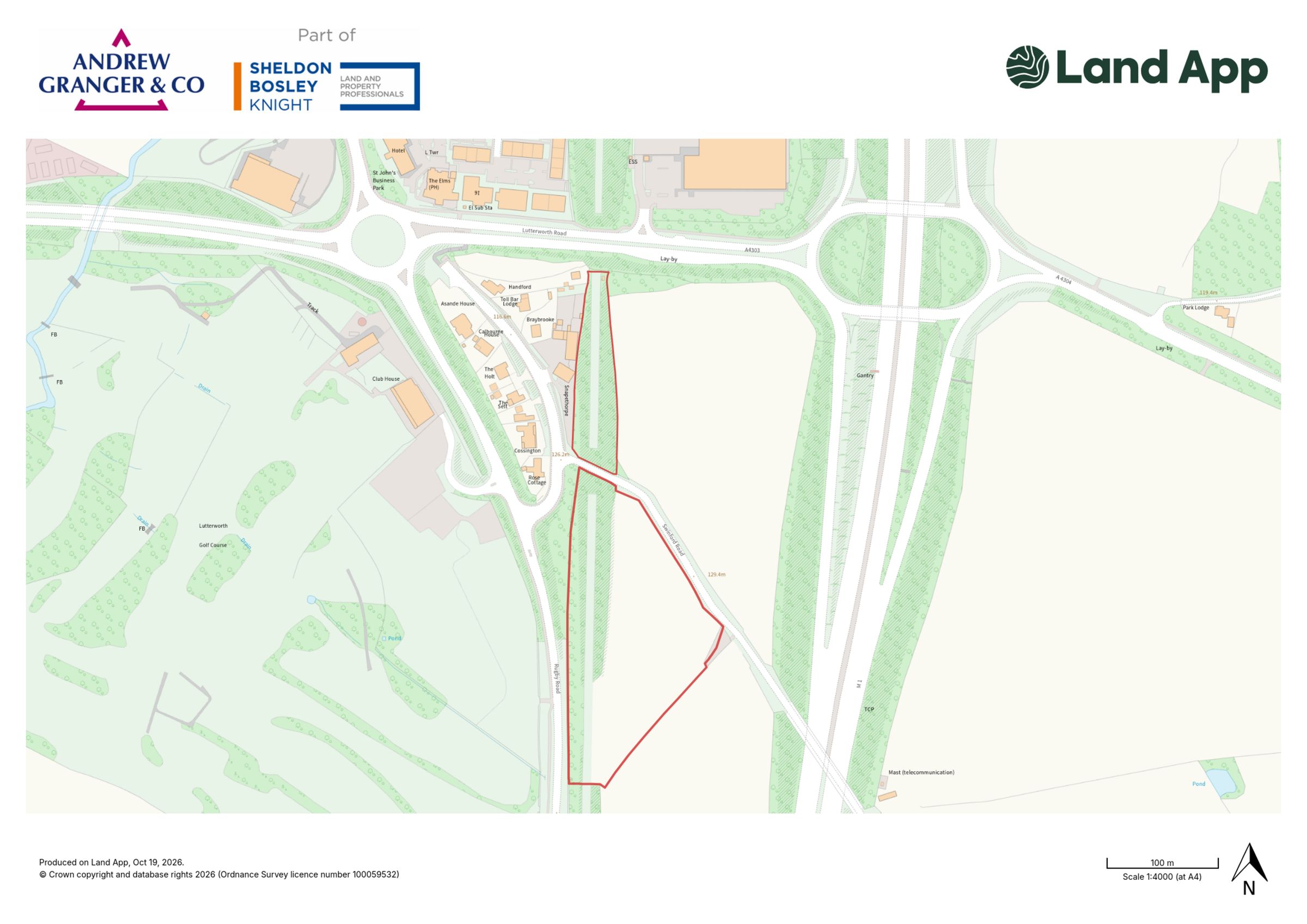
Two parcels of land separated by Swinford Road
About this property
Description
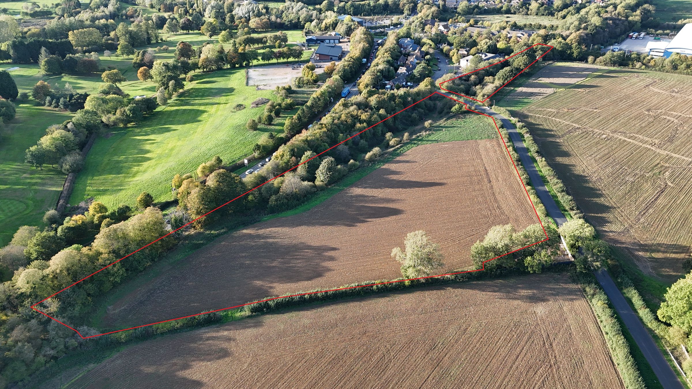
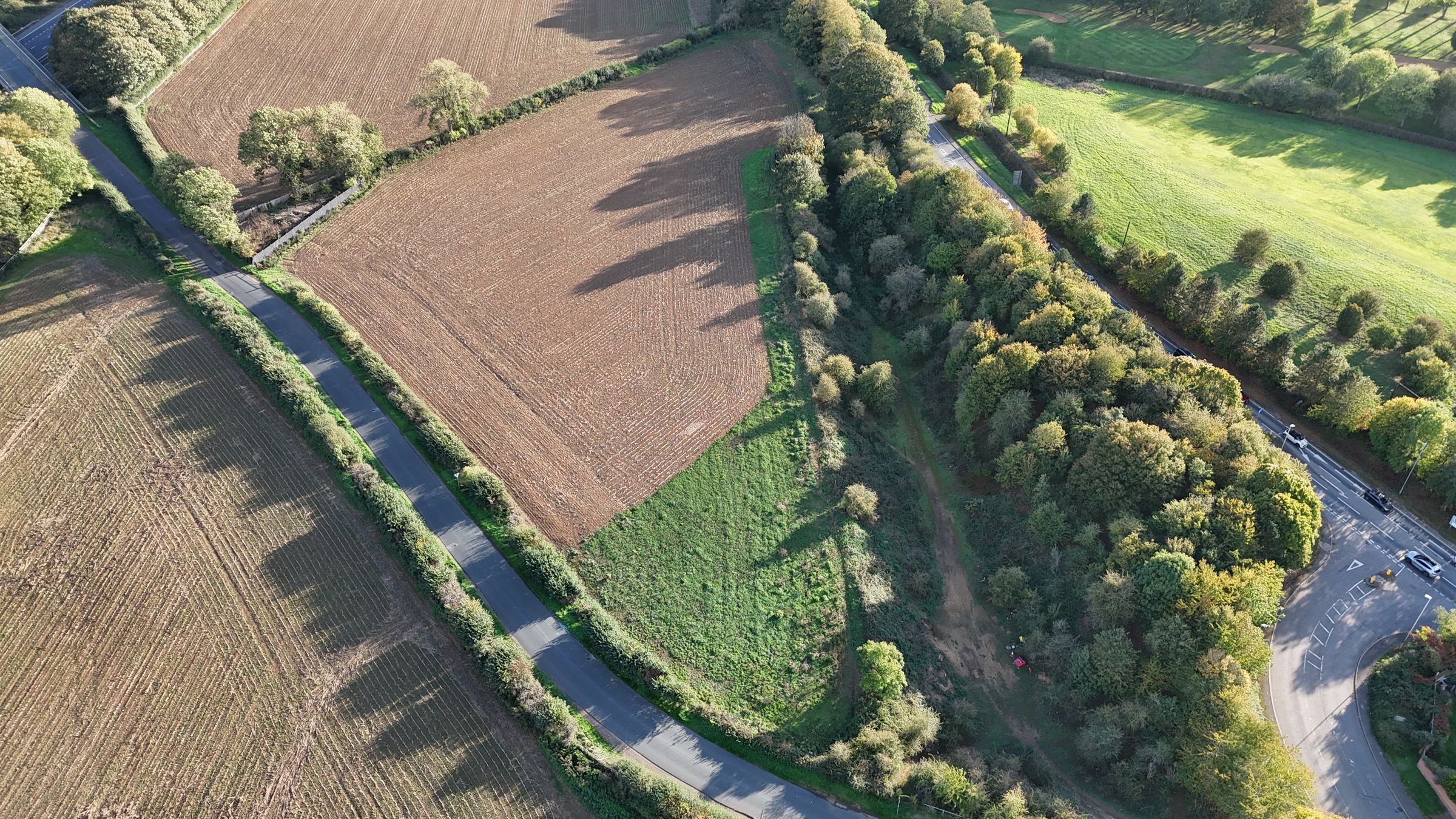
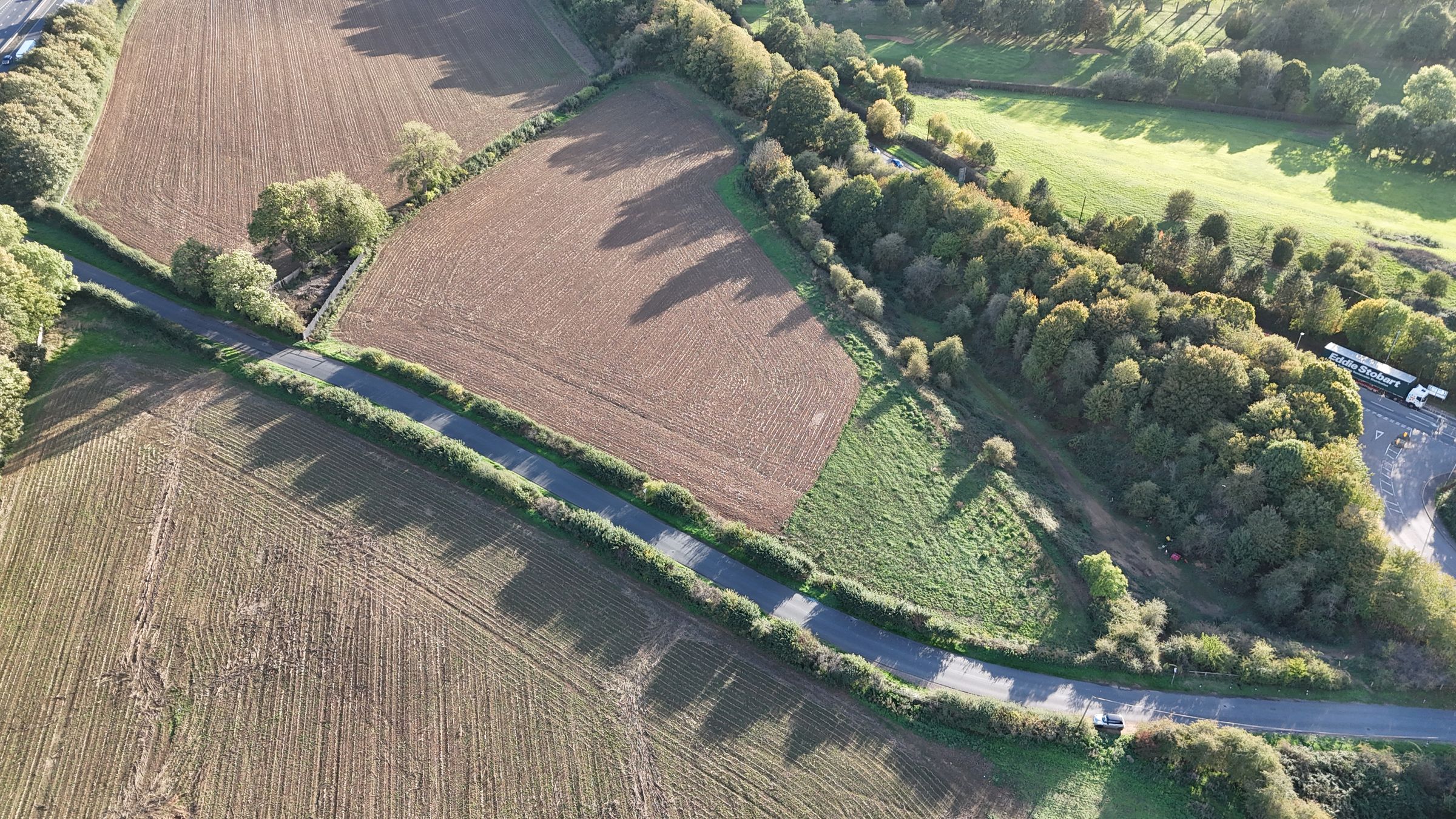
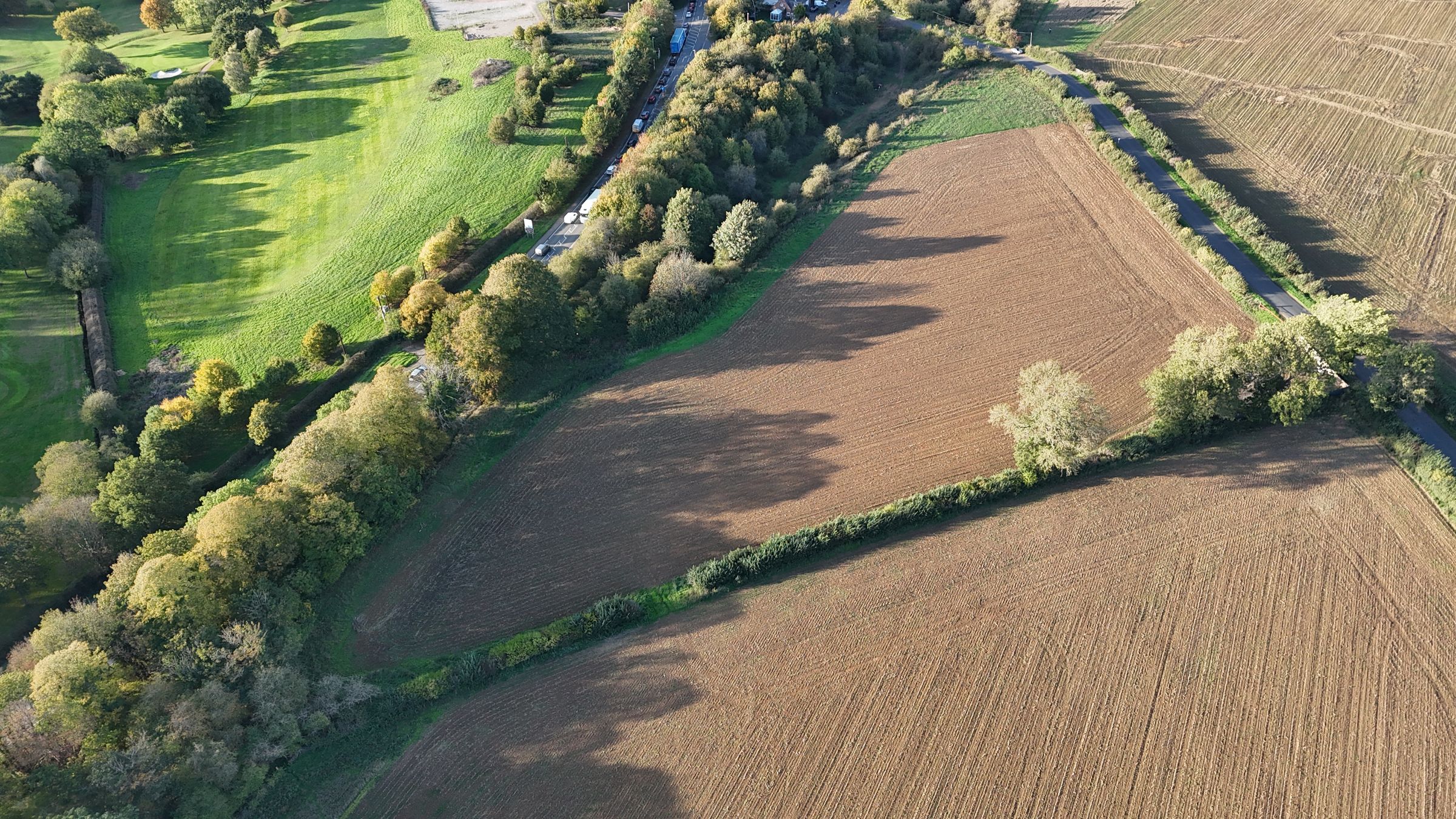
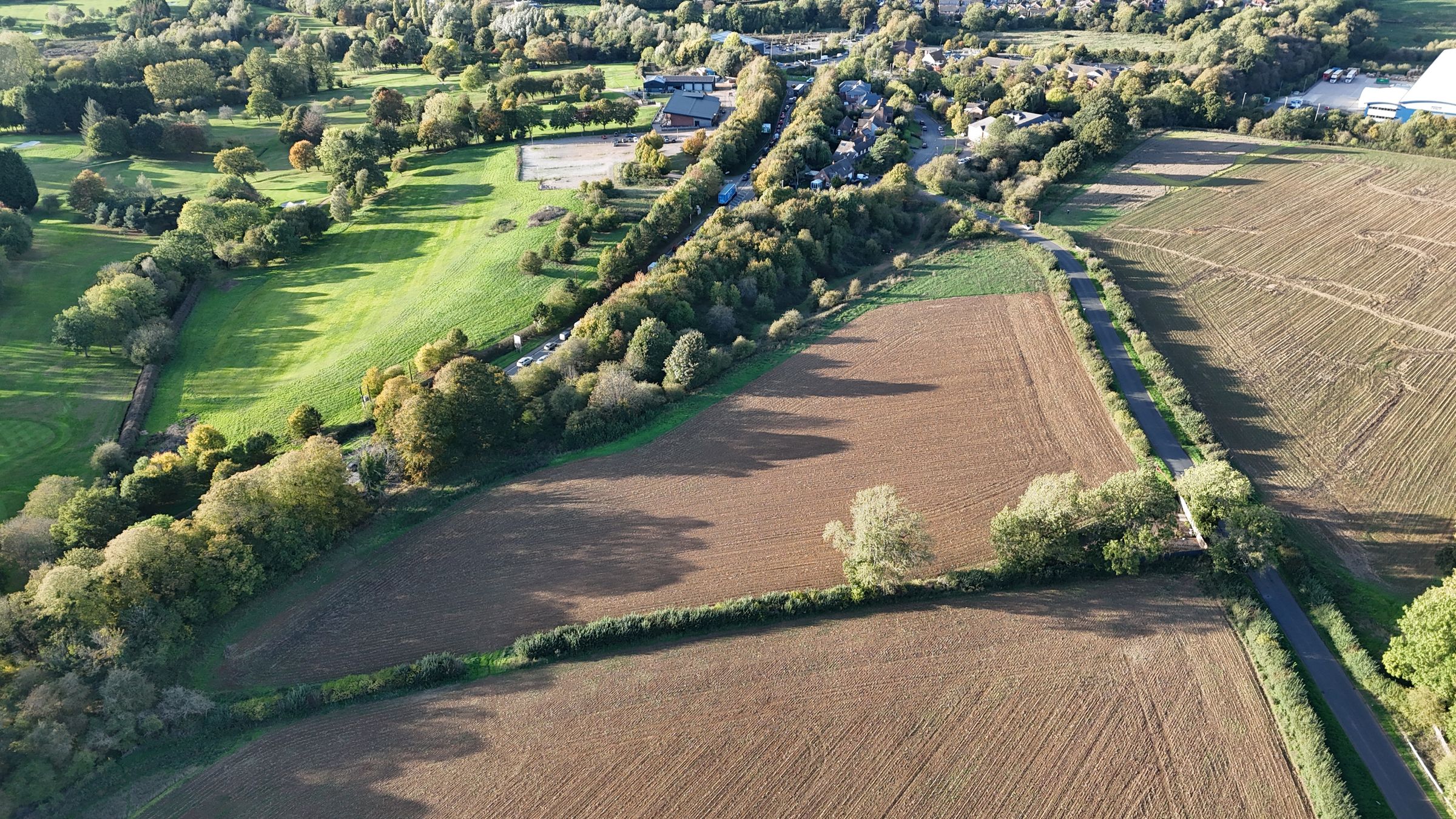
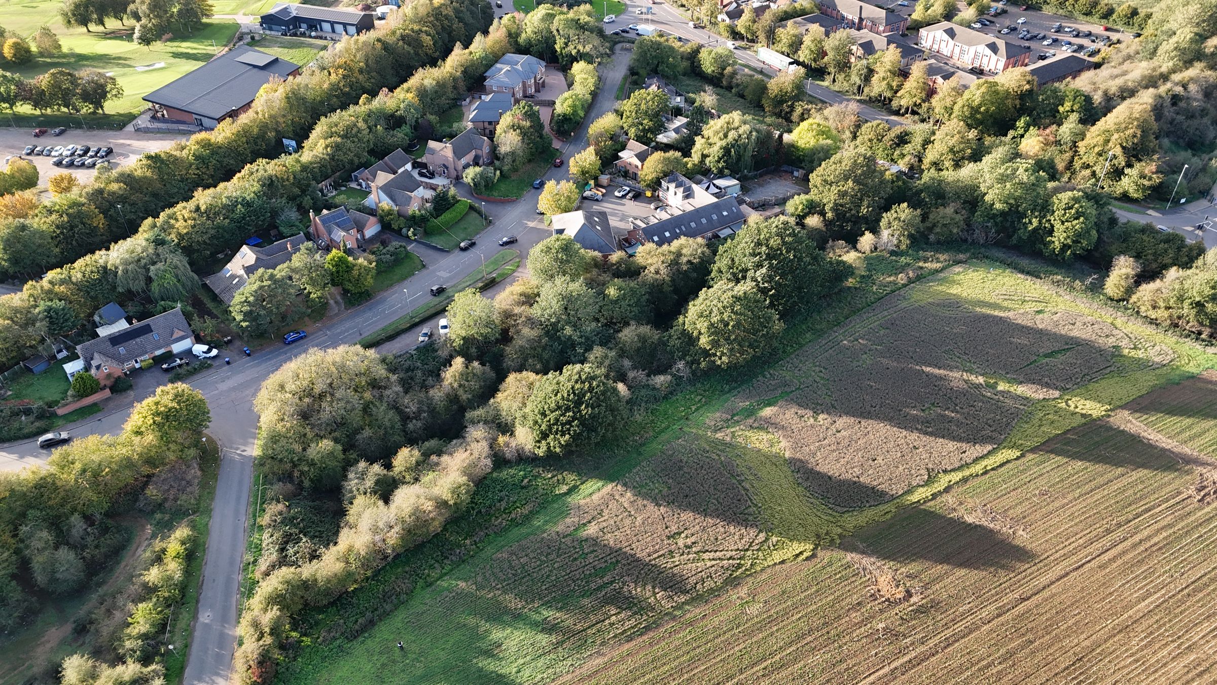
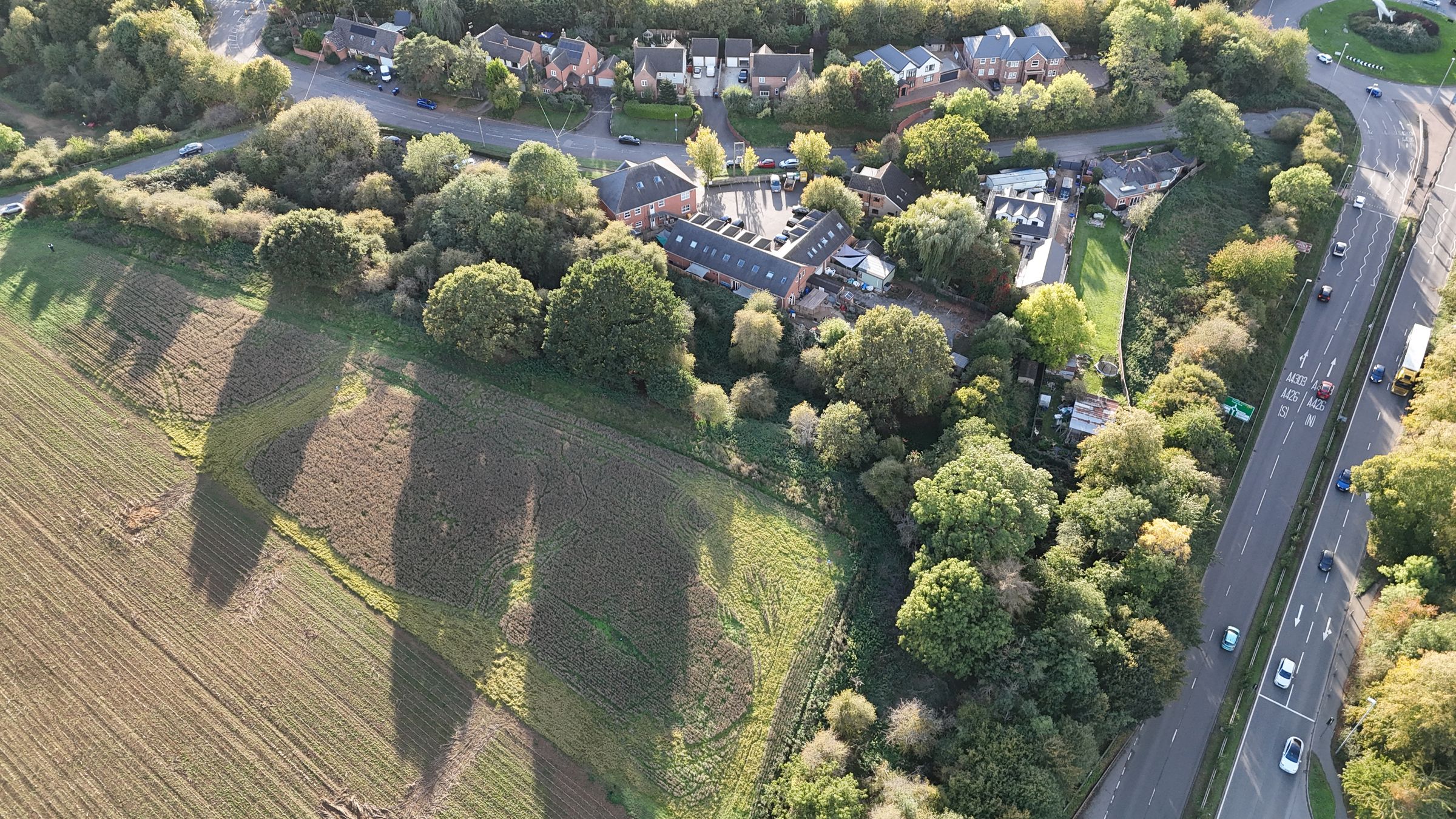
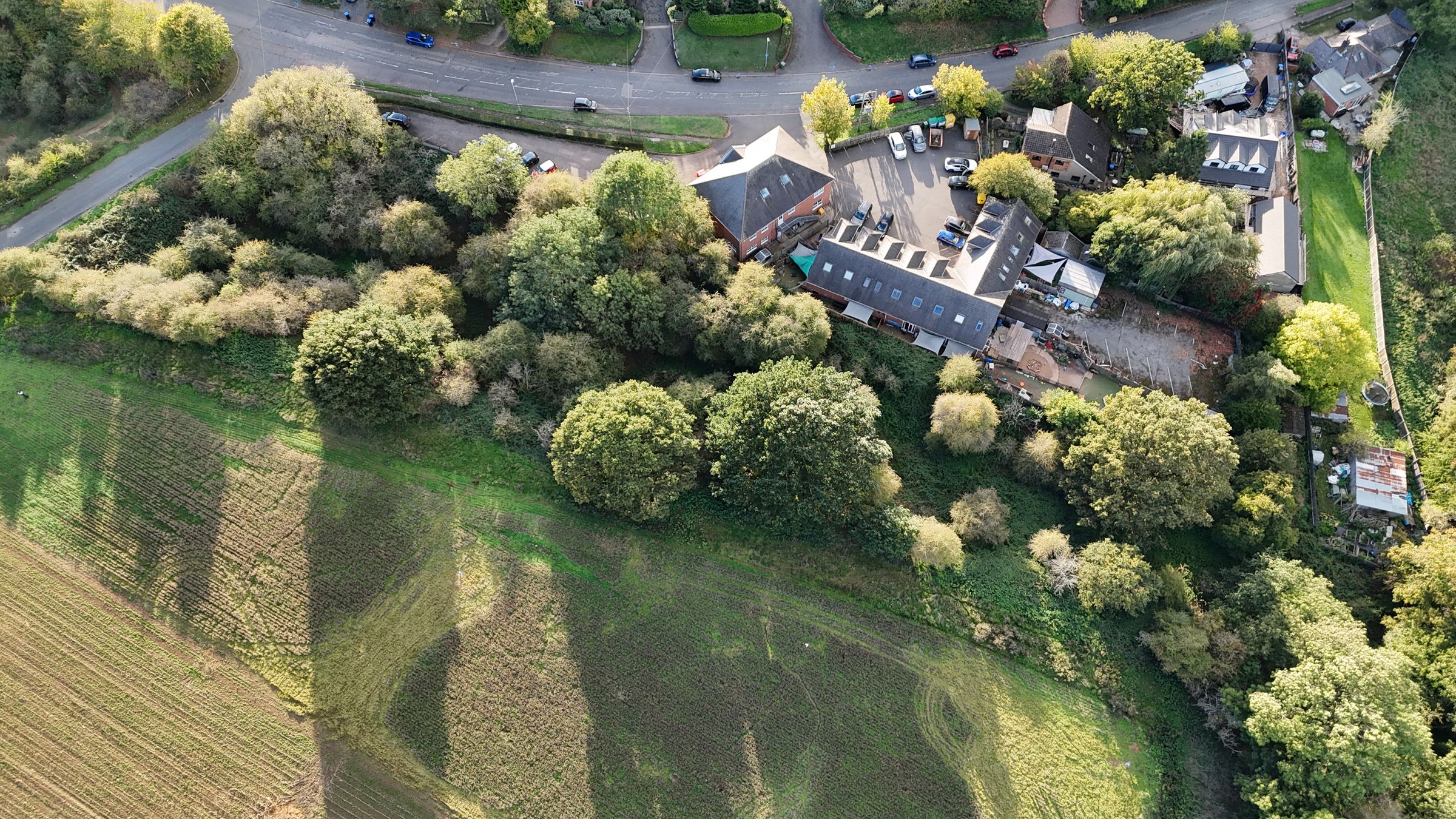
An exciting opportunity to acquire approximately 7.7 acres (3.12 hectares) of grassland in a strategic location on the edge of Lutterworth, directly opposite a consented site for 90 dwellings.
The land is divided into two separate parcels situated on either side of Swinford Road, both incorporating sections of a former railway line which have since become established woodland. The northern parcel comprises entirely former railway land and established woodland, whilst the other comprises grassland together with former railway land and woodland.
Key details
Freehold
Additional information
An EPC is not currently available for this property. Please contact us here or call us on 01509 243720 for more information.
- Is in a conservation area
- No
- Is a listed property
- No
Has flood defences
No
Has there been any flooding within the last five years?
No
- Construction materials
- Not specified
Near the property
Rooms and dimensions
LOCATION
The land is situated on Swinford Road, to the south of the market town of Lutterworth, Leicestershire. Lutterworth provides a range of local amenities including shops, supermarkets, public houses and schools. The land benefits from direct roadside access from Swinford Road and is conveniently positioned for the wider road network, including Junction 20 of the M1 motorway. A FOR SALE board will be positioned at the gateway to the land. The What3Words location is: ///hats.shuts.congested
GUIDE PRICE
The property is offered for sale as a whole at a guide price of offers over £225,000. Whilst the Sellers’ preference is to sell the property as a whole, they may consider separate offers for the woodland located to the north of the road.
METHOD OF SALE
The land is offered for sale via private treaty, The vendor and agent reserve the rights to conclude the sale via alternative methods if they deem neccessary.
LAND CLASSIFICATION AND SOIL TYPE
The arable land is classified as Grade 2 (very good quality land). Soilscapes defines the soil type as: 75% Soilscape 6: Freely draining slightly acid loamy soils and 25% Soilscape 18: Slowly permeable seasonally wet slightly acid but base-rich loamy and clayey soils.
TENURE
The northern woodland is offered for sale freehold with vacant possession. The southern block is freehold but currently subject to a Farm Business Tenancy. A Notice to Quit has been served, and vacant possession will be available from 29th September 2027.
PLANNING
The land lies within the administrative area of Harborough District Council, which is the local planning authority. The land is identified as lying outside the settlement boundary for Lutterworth. Immediately opposite the land is a site which benefits from outline planning permission for 90 dwellings (planning reference 25/00746/OUT). To the east, beyond the M1, lies the East of Lutterworth Strategic Development Area, which is mixed-use allocation in the adopted Harborough Local Plan. The selling agent is not aware of any planning applications or representations having been made in respect of the land itself. Prospective purchasers are advised to make their own enquiries with Harborough District Council regarding the planning status of the land and any potential for future development.
LOCAL AUTHORITY
Harborough District Council The Symington Building, Adam and Eve Street, Market Harborough, Leicestershire, LE16 7AG
SPORTING, TIMBER & MINERAL RIGHTS
All sporting, timber and mineral rights, where owned, are included in the sale.
RIGHTS OF WAY, EASEMENTS & WAYLEAVES
The agents are not aware of any rights of way, wayleaves or easements across the land. However, the property is sold subject to any other wayleaves, public or private rights of way, easements, covenants and all outgoings, whether mentioned in the sales particulars or not.
FLOOD ZONE
All of the property is located within Flood Zone 1 (Low Probability)
SERVICES
The agent is not aware that the land is connected to any services.
DEVELOPMENT UPLIFT CLAUSE
The property will be sold subject to a development uplift clause whereby 30% of any increase in value arising from development, implementation or the sale with the benefit of planning consent (excluding uses for agriculture and personal equestrian purposes), will be payable to the vendor for a period of 50 years from the date of completion.
LAND REGISTRY
The land is registered with the Land Registry: LT507445 & LT549577
VAT
In the event that any part of the land is subject to VAT, this will be payable by the purchaser in addition to the purchase price.
RATES & OTHER OUTGOINGS
The property is sold subject to any other rates and outgoings which the purchaser will be liable for.
ANTI-MONEY LAUNDERING CHECK
Due to regulatory requirements, we are legally required to undertake full identification checks on any prospective purchaser prior to proceeding with an agreed sale. These checks are carried out through our online system, Landmark, and include identity verification and facial recognition checks. A fee of £25 + VAT is payable by each prospective purchaser in respect of these checks.
PLAN
The plan and red lines provided are for reference purposes only. The vendor not the vendors agent are responible for defining the boundaries of the ownership.
VIEWINGS
Viewings of the land may take place at any time during daylight hours by persons who have registered with the selling agent. The selling agent requests that no disturbance is caused to tenants or neighbouring properties.
FURTHER INFORMATION
For any further information, please contact: Peter Chennells BSc (Hons) MSc MRICS Tel: 01509243720 Email: peter.chennells@sheldonbosleyknight.co.uk
View dimensions